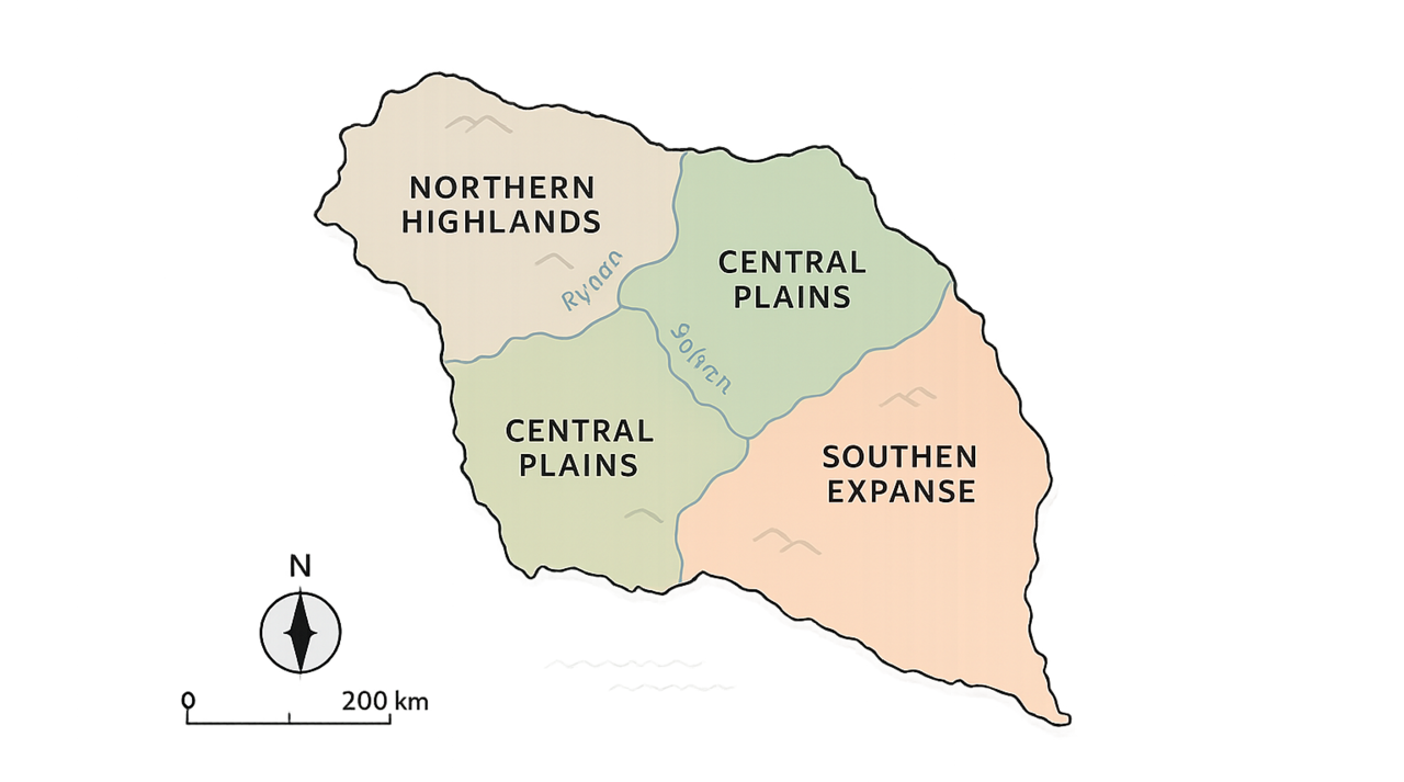
Geographic Facts
| Total Area | 812,000 km² |
| Highest Peak | Mount Virel (4,220 m) |
| Longest River | Rynar River (1,080 km) |
| Coastline | 1,300 km |
| Forest Coverage | 38% of total land |
| Average Annual Temperature | 17°C |
Rivers & Waterways
Rynar River
The longest river, supporting irrigation networks and riverine habitats across the plains.
Solven River
Flows from the highlands through major settlements, powering small hydroelectric stations.
Tareth River
Meanders through wetlands toward the sea, sustaining fisheries and bird sanctuaries.
Reservoirs & Wetlands
Engineered lakes and protected marshes regulate water flow and strengthen climate resilience.
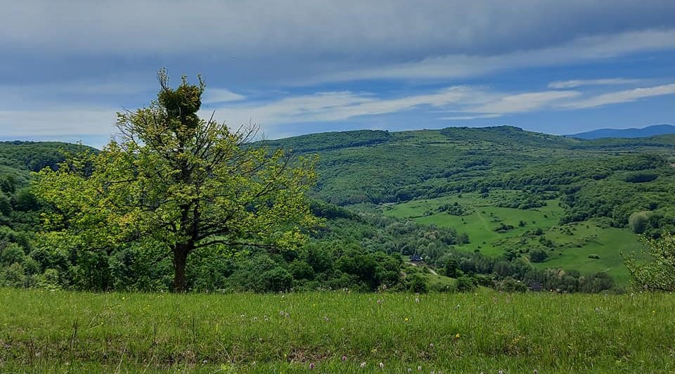
Northern Highlands
The Northern Highlands rise in layered shelves of basalt and granite, a long arc of peaks that gather mist at dawn and release clear, fast rivers by afternoon. Villages cluster along terraced slopes where hardy grains and alpine herbs take root in shallow soils, while conifer belts shelter red deer, cliff eagles, and shy marmots. Weather turns quickly here: bright sun to needled rain, then a sky rinsed clean by evening winds. The region anchors Aurania’s freshwater supply, feeds micro-hydro stations, and supplies trace metals from carefully managed mines. Footpaths and ridge roads thread through passes to high meadows used for summer grazing. Cultural life follows the mountain calendar—harvest fairs, stonecraft markets, and solstice songs carried valley to valley by bell and drum. Winters are crisp.
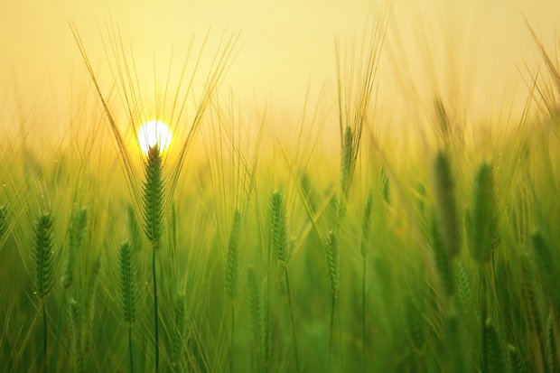
Central Plains
The Central Plains form a broad, breathing heartland: a quilt of loam-rich fields, hedgerows, and slow canals stitched between gentle rivers. From spring thaw to late autumn, tractors and hand crews share the horizon with cranes and herons, while grain, legumes, and seed oils rotate through parcels to keep soils alive. Wind moves like a steady tide across the flats, turning rows of turbines and guiding migratory flocks along age-old flyways. Market towns rise at river crossings, depots and drying sheds humming with trade. Irrigation co-ops meter water, blending reservoir releases and seasonal rains to buffer dry spells. Food hubs and mills cluster near rail spurs, linking farm co-ops to schools, clinics, and distant regions. Life follows a practical rhythm: dawn notes, noon shade, dusk repairs; festivals mark planting, first harvest, and the moon of tall straw. Though the land looks simple, it is engineered, a living grid that stores sunlight in grain and goodwill in granaries.
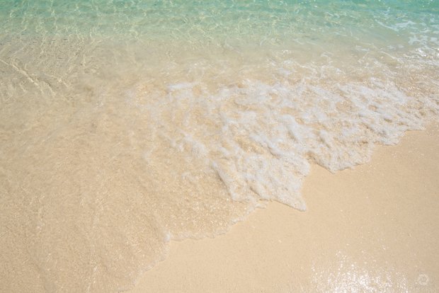
Eastern Coastline
The Eastern Coastline stretches in a long, bright arc where river deltas meet the open sea, braiding estuaries with sandbars, reed beds, and tidal creeks. Morning fog lifts to reveal fishing skiffs, pilot cutters, and slow ferries weaving between markers set by patient lighthouse keepers. Beyond the harbors, barrier islands temper storms, while dunes and salt meadows host terns, plovers, and wind-twisted shrubs. Maritime towns work to a saline clock: dawn auctions on the quay, nets mended by noon, and lanterned promenades after sunset. Aquaculture ponds raise sea greens and shellfish beside repair yards and modest canneries, feeding markets far inland by rail. Tourism peaks with warm currents and long swells—kite sails stipple the horizon, boardwalks hum, and wetlands ring with summer insects. Even so, the coast plans for rough years: living shorelines, setback codes, and elevated piers fold resilience into the everyday rhythm of salt and spray. Old songs cross flats at low tide.
On the map